Tornados, Heat, Life-Threatening Rip Currents: No Relief Mid-Week For New Jersey, Pennsylvania Tornados, Heat, Life-Threatening Rip Currents: No Relief Mid-Week For New Jersey, Pennsylvania
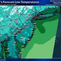
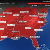
Tornados, Heat, Life-Threatening Rip Currents: No Relief Mid-Week For New Jersey, Pennsylvania It's another hot one in New Jersey in Pennsylvania. And a stormy one. And a dangerous one — both on land and at sea, forecasters warn. Yeah, finding relief Wednesday, June 26 won't be easy. "If you are thinking of getting relief at the beach, there is a High Risk for life threatening rip currents at NJ beaches today (Moderate Risk at DE beaches)," the National Weather Service (NWS) said. "Be sure to only swim where there are lifeguards, and never go in water when the beach is closed." Heat indexes could reach 100 degrees in parts of NJ and PA before storms roll in, the weather map above s…

Out With A Bang: Isolated Tornadoes, Severe Storms Likely To End Heatwave In NJ, PA Out With A Bang: Isolated Tornadoes, Severe Storms Likely To End Heatwave In NJ, PA
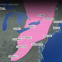
Out With A Bang: Isolated Tornadoes, Severe Storms Likely To End Heatwave In NJ, PA We're going out with a bang. The final day of heat and humidity in New Jersey and Pennsylvania is expected to precede a brand-new round of strong to severe thunderstorms ahead of the arrival of a cold front, the National Weather Service says. Storm activity on Sunday, June 23, will last from around 2 p.m. until around 11 p.m., with the most severe storms expected starting in the late afternoon and continuing into the evening. According to a weather map from the NWS, marginal storms are likely along the Jersey Shore with severe scattered storms possible across most of New Jersey a…

Video Shows Landspout Tornado That Flipped Cars, Uprooted Trees In NJ Town Video Shows Landspout Tornado That Flipped Cars, Uprooted Trees In NJ Town
Video Shows Landspout Tornado That Flipped Cars, Uprooted Trees In NJ Town The National Weather Service has confirmed a landspout tornado touched down in a New Jersey town last week. The EF-0 twister took down trees and flipped several cars in a post office parking lot for exactly one minute in Lawrence Township (Mercer County) on Friday, June 14. The NWS shared footage from Ross Kauffman of the tornado, which had peak winds of 80 mph, was .13 miles long and 60 yards wide. 🌪️ Here is a video from Ross Kauffman of the landspout tornado that occurred Friday in Lawrence Twp, NJ. What makes a... Posted by US National Weather Service Philadelphia/Mount Holly on&nb…
Air Quality Alert Issued Across Bergen County Air Quality Alert Issued Across Bergen County
Air Quality Alert Issued Across Bergen County An air quality alert has been issued for several areas across New Jersey and Pennsylvania  through late Friday, June 14. The most serious alert, an Air Quality Action Day, has been issued from 11 a.m. to 11 p.m. across Bergen, Passaic, Hudson, Essex, and Union counties. An Air Quality Action Day means that Ground Level Ozone within the region may approach or exceed unhealthy standards. The New Jersey Department of Environmental Protection has issued a code orange air quality alert Friday for North Central and Southwestern, NJ, along with Middlesex, Mercer, Camden, and G…
Here's Timing On Thunderstorms With 60 MPH Winds, Large Hail Threatening NJ, PA Here's Timing On Thunderstorms With 60 MPH Winds, Large Hail Threatening NJ, PA
Here's Timing On Thunderstorms With 60 MPH Winds, Large Hail Threatening NJ, PA A pleasant summer day Thursday, June 13 could be followed by a stormy one on Friday, June 14, forecasters said. Showers and thunderstorms with drenching downpours, large hail, and gusty winds are threatening North Jersey and the Lehigh Valley Friday afternoon and early evening, according to the National Weather Service. After a warm and sunny Thursday, we could be looking at a rather stormy Friday. Showers and thunderstorms are expected... Posted by US National Weather Service Philadelphia/Mount Holly on Thursday, June 13, 2024 Damaging wind gusts and large hail are the main threat…
New Round Of Thunderstorms Could End Sunny Day In NJ, PA, Weather Service Says New Round Of Thunderstorms Could End Sunny Day In NJ, PA, Weather Service Says
New Round Of Thunderstorms Could End Sunny Day In NJ, PA, Weather Service Says The National Weather Service says another round of thunderstorms is right around the corner. Wednesday, May 29 will start out sunny with a high of 78. Come the late afternoon, showers with "a few thunderstorms" and a chance of downpours are likely across New Jersey and parts of Pennsylvania, the NWS says. Storms are expected to being around 3 p.m., with a higher chance of heavier rain in North Jersey than South Jersey. Showers could stick around into Thursday, May 30 , which will will be mostly cloudy with a high of 75, the NWS says.
Tornadoes Possible, Severe Thunderstorm Watch Issued For All Of NJ, Parts Of PA Tornadoes Possible, Severe Thunderstorm Watch Issued For All Of NJ, Parts Of PA
Tornadoes Possible, Severe Thunderstorm Watch Issued For All Of NJ, Parts Of PA The National Weather Service issued a severe thunderstorm watch for all of New Jersey and eastern Pennsylvania to close out Memorial Day. The NWS said tornadoes, heavy rain, and wind gusts up to 65 mph were possible through 9 p.m. The first round of storms came early Monday morning, May 27.  National Weather Service As of press time, more than 600 Bedminster, NJ residents were without power, according to JCP&L. It was not immediately clear if that outage was caused by the storm, though. The NWS says storms are expected to cease before 1 a.m. Tuesday, May 28. Temps will dip…
Fast-Moving Storm Knocks Power To Thousands Across North Jersey Fast-Moving Storm Knocks Power To Thousands Across North Jersey
Fast-Moving Storm Knocks Power To Thousands Across North Jersey A fast-moving round of thunderstorm knocked power to thousands of New Jersey residents Thursday morning, May 23. PSEG was reporting approximately 2,000 outages in Bergen County (1,156 in New Milford, 398 in Paramus); 2,341 in Essex County (983 in Caldwell, 448 in West Caldwell); 1,230 in Gloucester County (1,206 in Woodbury City). JCP&L was reporting approximately 1,300 in Franklin Township, where a downed tree closed Route 57. JCP&L also said 1,000 residents in Lebanon were in the dark, as were 1,000 in Bethlehem. Knowlton, Hope, Liberty, and Independence …
Two Rounds Of Thunderstorms Predicted In NJ, PA: Here's Timing Two Rounds Of Thunderstorms Predicted In NJ, PA: Here's Timing
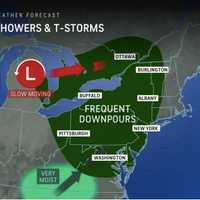
Two Rounds Of Thunderstorms Predicted In NJ, PA: Here's Timing The National Weather Service is predicting two rounds of thunderstorms in New Jersey and Pennsylvania on Thursday, May 23. The first is expected in the morning northwest of the I-95 corridor through noon, and the second in the afternoon and evening along the Jersey Shore and in South Jersey (see map above). The NWS warns that strong to severe thunderstorms could come with gusty winds. Travel delays due to flooding, downpours, and hail are expected, AccuWeather says. AccuWeather Temps will be in the mid-80s with a drop into the 60s in the evening, the NWS said. Friday will be mostly sun…
2.9 Magnitude Earthquake Rattles New Jersey 2.9 Magnitude Earthquake Rattles New Jersey
2.9 Magnitude Earthquake Rattles New Jersey New Jersey continues to be shaken by aftershocks. The latest, following the 4.8 magnitude quake that rocked the area on April 5, occurred just before 10 a.m. on Saturday, April 27, according to the USGS. This aftershock was among the highest in magnitude of the dozens of aftershocks since the initial earthquake. It was reported 7 km WSW of Gladstone, and according to the USGS map, east of Tewksbury. People as far as Massachusetts reported feeling the earthquake, but it appeared to have been clearest felt in the Garden State, with Boonton and Kearny residents reporting a III on the MMI…
Surprise Storm Could Follow Sunny Skies In NJ, PA: Forecasters Surprise Storm Could Follow Sunny Skies In NJ, PA: Forecasters
Surprise Storm Could Follow Sunny Skies In NJ, PA: Forecasters A powerful storm system is expected to move through the region following a day of idyllic weather in New Jersey and Pennsylvania on Sunday, April 14, forecasters say. Most of Sunday will be sunny with a high near 72, but come nighttime, the weather is expected to take a drastic turn, according to the National Weather Service. The storm will make its way to the Northeast from the Midwest during the afternoon hours, the greatest threat being wind gusts up to 50 or 60 mph and downpours. AccuWeather is warning travelers, noting the trek home from weekend trips could be a treacherous one. Mond…
Bright Green Fireball Blazes Across Bergen County Skies Bright Green Fireball Blazes Across Bergen County Skies
Bright Green Fireball Blazes Across Bergen County Skies An earthquake, a total solar eclipse and now a fireball. What a week for weather in the Northeast. Dozens of residents across the region reported seeing a bright green fireball blaze across the sky on before dawn on Wednesday, April 10. View this post on Instagram A post shared by Daily Voice NJ (@dailyvoicenewjersey) Linda Price-Heine captured a fireball in the sky Wednesday, April 10. Daily Voice Linda Price-Heine got a text from her neighbor, Joan Piney, in Wall Township this morning telling her to check her camera, she said…