Hazardous Weather Outlook Issued By National Weather Service For Powerful Christmas Eve Storm Hazardous Weather Outlook Issued By National Weather Service For Powerful Christmas Eve Storm Hazardous Weather Outlook Issued By National Weather Service For Powerful Christmas Eve Storm
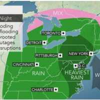
Hazardous Weather Outlook Issued By National Weather Service For Powerful Christmas Eve Storm The National Weather Service has issued a Hazardous Weather Outlook statement for a powerful system that will sweep through the area on Christmas Eve, bringing drenching rain, thunderstorms, and damaging winds that could cause power outages. The time frame for the storm is Thursday night, Dec. 24 into Friday morning, Dec. 25. "The combination of lingering snowpack and heavy rain may bring flooding, with the highest potential across northeast New Jersey, the Lower Hudson Valley, and southern Connecticut," said the National Weather Service statement, issued early Tuesday mornin…
Storm Will Be Followed By Gusty Winds, Drop In Temperatures Storm Will Be Followed By Gusty Winds, Drop In Temperatures Storm Will Be Followed By Gusty Winds, Drop In Temperatures
Storm Will Be Followed By Gusty Winds, Drop In Temperatures A storm system that has swept through the region will be followed by clearing, gusty winds and a drop in temperatures. Some parts of the region will see as much as 2 inches of rainfall from the system, which will wrap up later in the morning on Monday, Nov. 23. Skies will gradually clear after noontime just as strong winds move in. The temperature will fall in the afternoon from the mid 50s to the mid 40s on a breezy day with wind strength of 10 to 15 miles per hour and gusts up to 25 mph.  As a result, it will feel more like it's in the 30s by the time nightfall arrives. The overni…
Sunny Last Day Of Summer Will Be Followed By Scattered Storms, Big Change In Weather Pattern Sunny Last Day Of Summer Will Be Followed By Scattered Storms, Big Change In Weather Pattern Sunny Last Day Of Summer Will Be Followed By Scattered Storms, Big Change In Weather Pattern
Sunny Last Day Of Summer Will Be Followed By Scattered Storms, Big Change In Weather Pattern The summer of 2019 will be one for the books in just a matter of hours, and then a big change in the weather pattern will come, along with the end of a long stretch of dry days. So it's fitting that Sunday, Sept. 22, the last day of summer, will be, well, summer-like with the high temperature well above normal. It will be warm, with temperatures climbing into the low to mid 80s with plenty of sunshine and higher humidity. It could be the warmest last day of summer since 1980, in fact. The first day of fall, Monday, Sept. 23, could be even warmer with a high temperature in the mid 80s under…
Snow Way! Parts Of New York Will See White Stuff Just Days From Start Of May Snow Way! Parts Of New York Will See White Stuff Just Days From Start Of May Snow Way! Parts Of New York Will See White Stuff Just Days From Start Of May
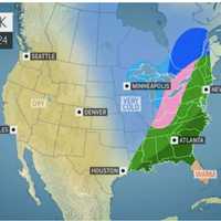
Snow Way! Parts Of New York Will See White Stuff Just Days From Start Of May Are you sitting?  OK. Here goes. Just days away from the start of May, some residents in the region, including a large part of New York State, may be seeing some snow this weekend. (See image above.) Snow showers could bring a coating of accumulation as far south as the northwestern Hudson Valley, including Sullivan County. The white stuff is expected early Sunday morning, April 28 as a round of precipitation moves west to east. It's the same storm that is bringing up to 6 inches of snowfall to some states in the northern Plains and Great Lakes regions early in the weekend. In this …
Flash Flood Watch: Significant Storm System Will Bring Downpours, Delay Holiday Travel Flash Flood Watch: Significant Storm System Will Bring Downpours, Delay Holiday Travel Flash Flood Watch: Significant Storm System Will Bring Downpours, Delay Holiday Travel
Flash Flood Watch: Significant Storm System Will Bring Downpours, Delay Holiday Travel A significant storm system in the pre-Christmas travel days at the end of the week is headed our way.  Heavy rain, wind, and coastal flooding are all likely. A Flash Flood Watch is now in effect from 1 a.m. Friday, Dec. 21 until 1 a.m. Saturday, Dec. 22. The National Weather Service is now forecasting 1.5 to 2.5 inches of rain with locally higher amounts, especially in any thunderstorms, with most of the area in a marginal risk for excessive rainfall. It looks to be too warm for any snow across the region. The forecast will be fine-tuned with amounts and when to expect the heaviest r…
New Round Of Soaking Rain, Gusty Winds, Storms Coming Our Way, Including On Election Day New Round Of Soaking Rain, Gusty Winds, Storms Coming Our Way, Including On Election Day New Round Of Soaking Rain, Gusty Winds, Storms Coming Our Way, Including On Election Day
New Round Of Soaking Rain, Gusty Winds, Storms Coming Our Way, Including On Election Day Sunday's sparkling skies and pleasant conditions will prove to be the calm before a new round of storms with soaking rain and gusty winds at the beginning of the workweek. The stormy stretch comes after a storm system swept through the area, bringing heavy downpours overnight Friday into Saturday, followed by high winds that caused thousands of power outages. After clouds increase overnight Sunday into Monday, rain will arrive after 9 a.m. Monday and continue through late in the evening on a day in which the high temperature will be in the low-50s. Up to a half-inch of rain is pos…